Last weekend, Clay and I rode our bicycles on the Great Allegheny Passage from Cumberland, MD to Meyersdale, PA and back, breaking up the trip by staying overnight at Yoder’s Motel in Meyersdale (they don't have a website, but it was a great hotel and was right by a Sheetz and a fabulous restaurant - Take Six). I need to say before getting into the trip that the first 24 miles was all uphill. From Cumberland, we climbed a 1.75% grade until we hit the Eastern Continental Divide. It was torture. Had I been alone I would have backed out after the first two miles. But I didn’t want to let Clay down, and I knew I would also be letting myself down if I quit, so I kept going. My GPS said I averaged a speed of 4.9, if that tells you anything. The first day we did 32.85 miles and it took us 6 hours, 40 minutes. The second day we did 36 miles in 4 hours, 10 minutes.
Over winter, I gave myself the goal of climbing this mountain, but only in the fall after things cooled down since it’s hard to do anything too physical in Pennsylvania’s hot, humid summers. For some reason, the opportunity came to do this earlier and I took it. I lucked out with the weather, as it was in the low 80s on the first day and high 70s and cloudy the second. I even biked through a rainstorm! That mountain was awful, but in the sentiment of Dorothy Parker, I hated climbing it but I loved having climbed it. And after I finished I felt like the luckiest girl alive. But I guess I always feel lucky when I bike. You get to see secret pockets of nature that only a select few others get to see. For days after I was on a high. I felt better than I ever had before, both mentally and physically. In fact, Hannah and I planned a bike trip for August (she feels the same way about the views that a bike trail has to offer!), and Clay and I have two more planned. One for July and one for the fall (date TBD).
What's that? You want to see pictures?! Why, I just so happen to have a few ready for you. Of course, they come with a bit of commentary.
Big Savage Tunnel followed by Borden Tunnel. I believe Big Savage is 3/4 mile long. It's lit inside though, whereas the other tunnels are not. Good thing Clay got me a bike headlight!
One of the many beautiful bridges we got to cross.
Here's another one, but this one was special. It was made in the 1800s and relocated twice, most recently in 2006 when it was saved from oblivion by a wonderful group of people who wanted it for the trail. Look at that design!
This is my favorite shot from the trip, I think.
This was the summit of the trip. You'll see the elevation chart in a minute.
This picture captures, quite accurately, the way I felt while climbing the mountain.
These are not in any specific order, but this was on day two. We biked a few miles in the opposite direction to see the Salisbury Viaduct.
In Cumberland, where it all starts. Or ends.
I adore my bicycle. Absolutely adore it. The panniers that I ordered didn't fit properly and I ran out of time to fix them, so I had to use the cooler again. Since the trip, Clay has fixed them using his super-duper engineering skills. Because he's cool like that.
Looking at the highway from the viaduct.
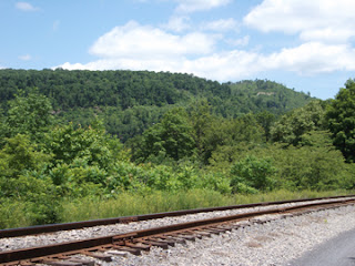
Just some scenery from various points of the trail.
On the climb up we saw a rattlesnake. Yes. A rattlesnake. I nearly shit myself.
And the best one. See that large drop in elevation to the left of where I'm pointing? Yep, I just climbed that.
As for calories, the websites I found to do an estimate varied drastically. Not to mention I couldn't plug in the exertion factor (I DID climb a mountain, after all!). So as usual, I went with a conservative number.
Day one; 32.85 miles: 2,745 calories burned
Day two; 36 miles: 1,720 calories burned


No comments:
Post a Comment